Global Search allows you to ask precise questions across your entire network and get immediate answers. Working hand in hand with our platform analytics, Global Search offers both a 30,000-foot view of your entire operation and the ability to quickly drill down into the highest-risk assets, making maintenance planning more efficient, safe, and cost-effective.
Magnifying Glass icon
Search to quickly find and drill down into relevant assets
Overlapping Circles icon
Combine data types to create multi-layered queries and save for regular review
Filter icon
Apply filters to target hyperspecific areas of interest
Color Palette icon
Use color-coding tools track and display the distribution of attributes
For example, identifying which bridges across your network need maintenance requires finding the areas of track that are both close to bridges and also trending poorly. Without an automated tool to combine these parameters, the task could require thousands of individual assessments of condition data corresponding to the location of each bridge. Global Search, with its flexible search criteria, can propagate the locations immediately and filter for the worst-trending areas, allowing you to establish your risk and respond efficiently.
No filters applied
1,220,067 assets  |  22,103 mi
Dense grid of hundreds of squares, all shaded blue
Targeted filters applied
23 assets  |  4.5 mi
BRIDGE
param = surface
expires in the next 6 months
Dense grid of hundreds of squares, with three squares singled out and shaded blue. The rest are all a faint gray.
Global Search includes several distinct views with different purposes, from showing track and subdivision overviews to mapping information geographically. New cards and components are regularly added to these views, as we work with clients and determine where new information and insights will be most effective.
Global Search Subdivisions View graphic
Subdivisions View
Shows you at a glance which subdivisions have areas of interest, and how much track matches your criteria.
Global Search Track View graphic
Tracks View
Maps matching data along the length of each track, providing a detailed shape of each track.
Global Search Assets View graphic
Assets View
Gives detailed information about each segment of track, sorted and filtered by the criteria you set.
Global Search Map View graphic
Map View
Displays data over satellite, road, or blank map layers to clarify geographically-based insights.
Global Search Workspace View graphic
Workspace View
Provides a synchronized view of linear data channels, profiles, video or line scan imagery, or any other information you provide and configure.
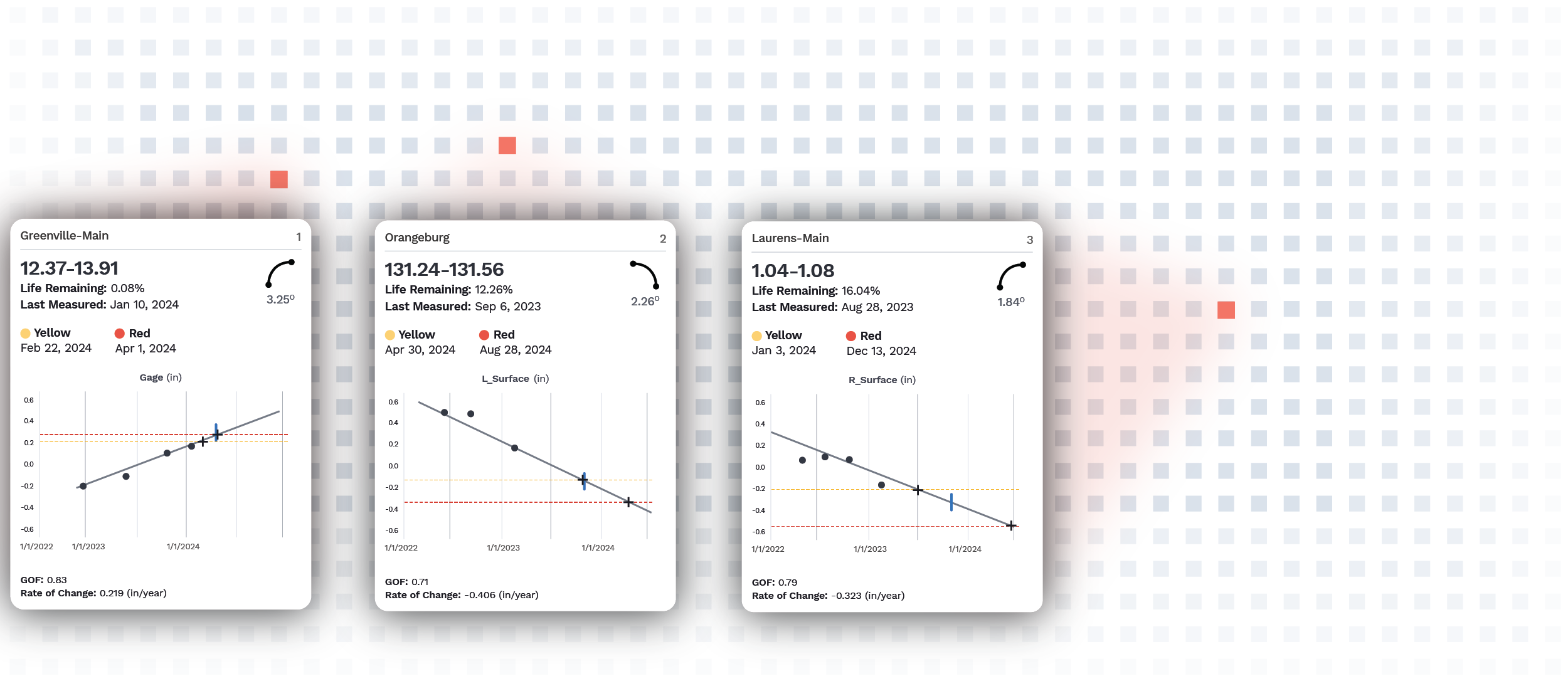
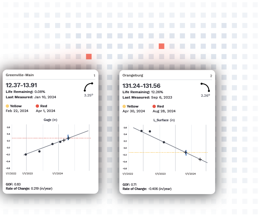
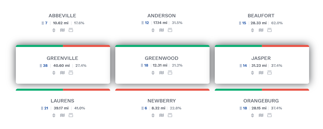
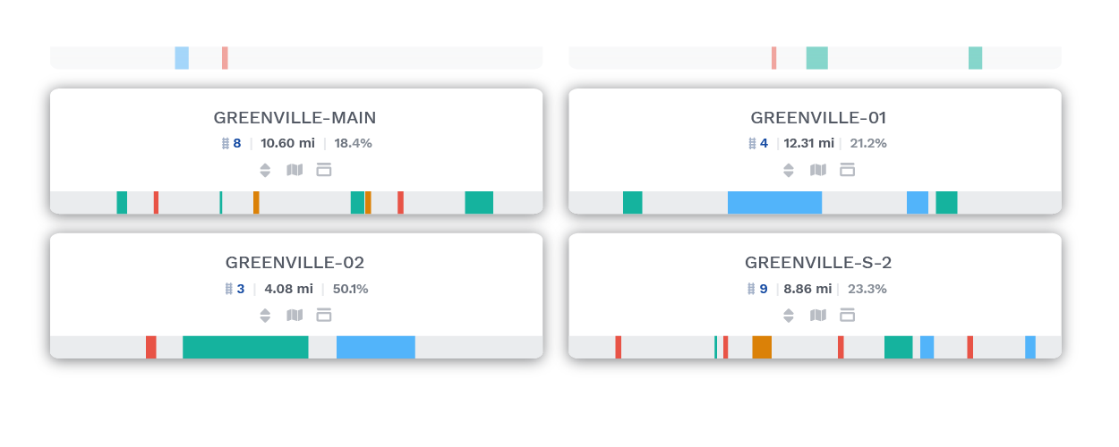
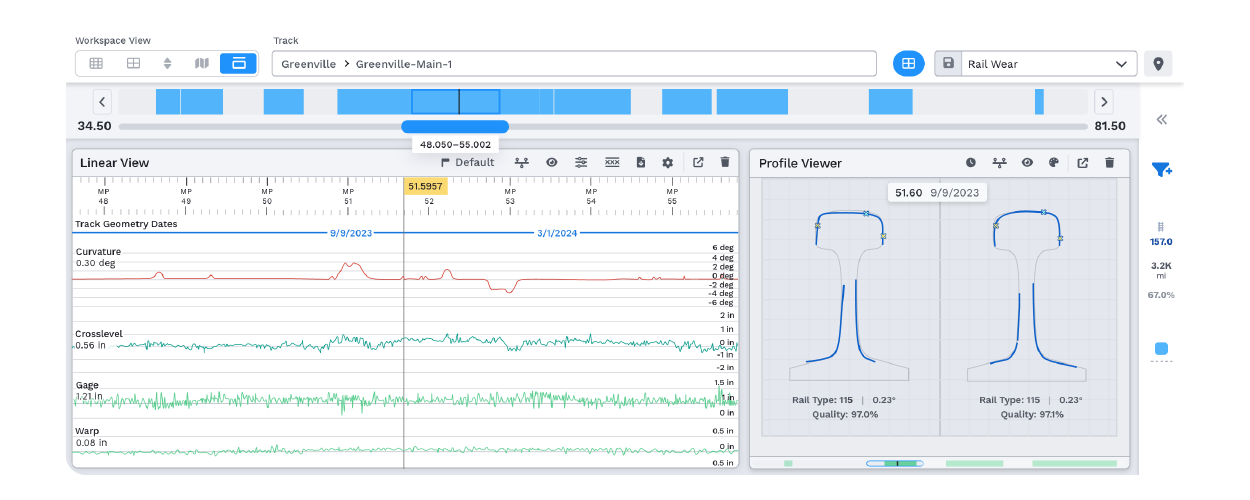
Of course, the quality of searches also depends on the quality of data architecture. As part of VisioStack’s broader RailLinks® Infrastructure platform, Global Search operates on a strong base of data organization and cutting-edge analytic tools to pull together condition data, asset data, and operation data across your entire network to produce an instantaneous and actionable risk assessment.
Photo of a rail yard in a tropical location, with train cars and a clock tower.